Search Montague County Property Records, Review the 2026 Appraisal and Pay the Correct Tax Collector
Use this guide to find an official Montague County Appraisal District account, compare 2026 land and improvement values, verify exemptions, identify real, personal or mineral property, prepare a protest or correction request and reach the correct tax-payment office.
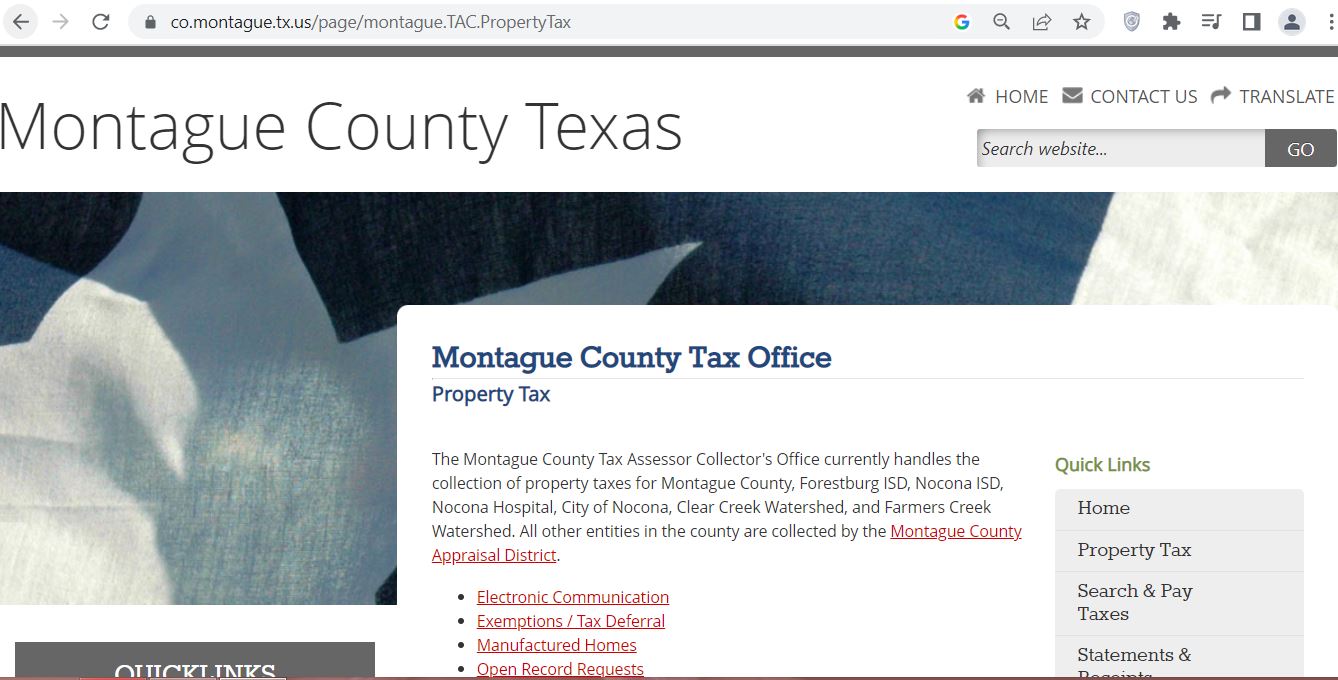
Montague County has a split collection system. MCAD collects taxes for several cities and school districts, while the separate Montague County Tax Office collects county, Nocona, Forestburg, hospital and watershed accounts. Always check the collector shown on the actual statement before paying.
Quick Answer: Which Montague County Office Should You Use?
Use Montague CAD for
Property searches, ownership display, appraisal values, land and building data, exemptions, agricultural appraisal, renditions, mineral accounts, notices and appraisal protests.
Use MCAD tax collection for
Statements and payments involving Bowie ISD, Goldburg ISD, Montague ISD, Prairie Valley ISD, Saint Jo ISD, City of Bowie and City of Saint Jo.
Use the County Tax Office for
Montague County, Forestburg ISD, Nocona ISD, Nocona Hospital District, City of Nocona, Clear Creek Watershed and Farmers Creek Watershed taxes.
Use the County Clerk for
Recorded deeds, deeds of trust, liens, releases, easements, mineral instruments, plats, foreclosure notices and certified copies.
Use a title professional for
Complete ownership, lien, easement, mineral-reservation and chain-of-title research for a sale, loan, probate matter or lawsuit.
Use a licensed surveyor for
Exact property corners, acreage, fence lines, encroachments, access, setbacks and legal boundary questions.
Fast routing rule: Value, exemption, agricultural, property-data and protest questions belong with MCAD. Payment, balance and receipt questions belong with whichever collector appears on that property’s tax statement.
Start Here: Choose the Montague County Task You Need
The supplied screenshot shows the Montague County Appraisal District property and tax portal. Across the top are search choices for owner name, property address, legal description, Geographic ID and Property ID.
Official Montague CAD portal with multiple search methods for homes, land, business accounts and mineral property.
1Verify the district portal
Confirm the page identifies Montague County Appraisal District and displays the MCAD phone number, 940-894-6011.
2Choose Name for an owner search
Enter the beginning of the last name. The portal recommends at least two characters and fewer words initially.
3Choose Property Address
Enter the street number and core street name without Street, Road, Drive, Lane or another suffix.
4Choose Legal Description
Use this route for subdivisions, lots, blocks, abstracts, surveys, rural tracts and land without a reliable address.
5Choose Geographic or Property ID
Use an exact identifier from a notice, statement, deed file, prior search or closing document.
6Use the lower menu after matching
Open exemptions, downloads, publications, protest data, tax rates or electronic communication only after confirming the account.
Best screenshot route: Search the property, click View Details, save the Property ID and Geographic ID, review the legal description and then open the Tax Summary, appraisal notice or other required tab.
How to Search Montague County CAD Property Records
Start with owner name when the owner is known.
Enter the beginning of the last name, such as “Smith A.” Avoid entering a complete name on the first attempt.
Use at least two characters.
The portal requires a meaningful partial name and recommends avoiding spaces in the first search.
Use the address tab for a home or business.
Enter the street number in the Number field and the core street name in the Street Name field.
Remove the street type.
Search “123 Main” rather than “123 North Main Street” when a complete address returns no result.
Use legal-description search for rural land.
Search subdivision, lot, block, abstract, survey or other wording shown on a deed or prior appraisal record.
Use Geographic ID for a map-based match.
Copy the exact Geographic ID from a known account rather than guessing its format.
Use Property ID for the cleanest match.
Enter the complete account number, including its R, P or N prefix.
Open every plausible result.
One owner can have separate residence, vacant-land, business, manufactured-home and mineral accounts.
Review the current year and account alert.
Confirm that 2026 is selected and check whether the page labels the value preliminary, uncertified or updated.
Save a dated copy.
Print or save the property account and appraisal notice before protesting, filing an exemption, buying or paying.
Local search tip: Bowie and Nocona city property often responds to address searching. Ranches near Montague, Saint Jo, Forestburg, Sunset or Ringgold may be easier to identify by owner, abstract, survey, Geographic ID or Property ID.
Understand Montague CAD Property ID Prefixes
R — Real estate
Homes, commercial buildings, vacant lots, farms, ranches and other land accounts generally begin with R.
P — Personal property
Business furniture, machinery, equipment, inventory and other income-producing tangible property generally begin with P.
N — Mineral property
Oil, gas, royalty, leasehold and other mineral-related accounts generally begin with N.
Do not combine account types: Paying or protesting the R account does not automatically address a related P or N account.
Five Checks Before You Rely on an MCAD Result
Property ID
Match the complete R, P or N account.
Geographic ID
Confirm the location-based identifier.
Owner wording
Check individuals, trusts, estates and companies.
Legal and situs
Match the physical property and legal description.
Collector
Confirm who collects every taxing entity.
Payment-risk warning: A correct property match is not enough. You must also confirm whether MCAD or the County Tax Office collects the taxes shown on that account.
Montague CAD Search Problems and Practical Fixes
Search Problem
What to Try
What to Verify
Full owner name gives no result
Use only the beginning of the last name.
The record may use initials, a trust, estate, spouse or business name.
A recent buyer is missing
Search the seller or previous owner.
Compare MCAD with the latest County Clerk deed.
Full address gives no result
Remove directions, street type and unit number.
The appraisal situs may use highway, farm-to-market or county-road formatting.
Rural property has no useful address
Use legal description, abstract, survey, Geographic ID or Property ID.
Match the acreage and deed description.
Mineral interest cannot be found
Search the mineral owner and an N-prefixed Property ID.
Surface ownership does not prove mineral ownership.
Business equipment is missing
Search the business name, DBA, owner and P-prefixed account.
Real estate and business personal property are separate records.
Manufactured home is missing
Search the home owner and landowner separately.
The home and land may have different owners and accounts.
Tax balance cannot be found
Search both the MCAD account and County Tax Office portal.
Identify the collector assigned to each entity.
“I am trying to identify the correct Montague CAD account. The owner or prior owner is ______, the property is near ______, and my deed or tax statement shows ______. Can you confirm the Property ID, Geographic ID, account type and tax collector?”
How to Read a Montague County Property Record
Record Field
Plain-English Meaning
What to Check
Property ID
MCAD’s identifying number for the account.
Confirm the R, P or N prefix and complete number.
Geo ID
A location-based appraisal identifier.
Use it to confirm the correct parcel or tract.
Property alert
A warning about preliminary, uncertified or otherwise limited data.
Do not treat preliminary values as final certified values.
Ownership
The owner wording and ownership interest displayed by MCAD.
Use recorded deeds or probate documents for legal ownership.
Qualified exemptions
Approved homestead, age, disability, veteran or other relief.
Not every confidential exemption detail is displayed online.
Legal information
Acreage, abstract, survey, subdivision, lot, block or tract wording.
Compare it with the deed, plat or survey.
Improvements
Houses, garages, shops, pools, porches and other structures.
Year built, square footage, description, condition and removed buildings.
Land details
Land code, acres, market value and productivity value.
Homesite, nonqualifying acreage and agricultural acreage.
Total market value
The district’s January 1 market-value estimate.
Compare with sales and actual property condition.
Agricultural loss
Difference created by qualifying productivity appraisal.
Confirm the correct qualifying acreage and use.
Cap loss
Value excluded by an applicable homestead or circuit-breaker limitation.
A cap does not establish that market value is correct.
Deed history
Selected prior conveyance references held in the appraisal file.
Use the County Clerk system for the actual recorded documents.
Tax estimation
An estimate using displayed values and rates.
The portal warns that the estimate is not a tax bill and should not be paid.
Research-only warning: MCAD’s ownership, acreage, deed-history and mapping information is maintained for property-tax administration. Verify legal ownership and boundaries independently.
Montague County’s 2026 Appraisal and Tax Calendar
MCAD announced that reappraisal notices were mailed on May 8, 2026 and published June 8, 2026 as the last day to protest those values.
January 1, 2026
Ownership, taxable location, property use and market conditions are generally measured.
April 15, 2026
Regular business-personal-property rendition deadline unless a valid extension was filed.
April 30, 2026
MCAD’s published agricultural and homestead application deadline.
May 8, 2026
MCAD mailed reappraisal notices.
June 8, 2026
MCAD’s published last day to protest the mailed 2026 reappraisal notices.
July 1, 2026
MCAD states unpaid delinquent taxes can incur an additional 20% attorney fee.
August–September
Local taxing units propose and adopt 2026 tax rates.
January 31, 2027
Normal payment deadline for 2026 taxes, subject to statutory weekend and notice rules.
July 31, 2026 status: The June 8 regular protest date has passed. A later notice, missing-notice claim, late exemption or statutory correction procedure may still create a property-specific option.
How to Use Map/GIS from a Montague CAD Account
Find the property record first.
Save the Property ID, Geographic ID, owner, situs and legal description.
Open View Details.
Do not rely only on the search-result row.
Select Map/GIS.
The Map/GIS route appears with the property-year and Tax Summary options on the full account.
Match the mapped account.
Compare the Property ID and Geographic ID with the appraisal page.
Review adjoining parcels.
Look for separate lots, homesites, lake lots, ranch tracts, access strips and related ownership.
Use aerial imagery as research.
It may help identify buildings, roads, water, terrain and apparent land use.
Verify boundaries professionally.
Use the deed, recorded plat, title work and a licensed surveyor before fencing or building.
Lake-property warning: Property near Lake Nocona or Lake Amon G. Carter may involve plats, easements, access, water boundaries or restrictions that cannot be resolved from the appraisal map alone.
Montague County Homestead and Property-Tax Exemptions
Exemption applications are filed with Montague County Appraisal District. MCAD’s portal links current forms, and the district states that the applicant’s driver-license or state-ID address generally must correspond with the claimed homestead address.
Exemption or Relief
2026 Starting Point
What to Prepare
General residence homestead
Texas school districts provide a mandatory $140,000 exemption.
Ownership, principal-residence details and required identification.
Age 65 or older
Eligible owners receive an additional mandatory $60,000 school exemption and may qualify for a ceiling.
Age, ownership and residence information.
Disabled person
Eligible owners may receive the additional school exemption and applicable ceiling protection.
Documentation meeting the statutory disability definition.
Disabled veteran
Partial or total relief depends on the qualifying veteran or survivor category.
VA and applicable service, disability or survivor records.
Heir-property homestead
An occupying heir may qualify even when not individually listed on a recorded deed.
Affidavit, death certificate, utility record and available court documents.
Local optional benefits
Cities, county, schools and special districts can provide different local exemptions.
Review each entity shown on the live account.
Homestead Application Micro-Steps
Find the correct R-prefixed Property ID.
Match the owner, address and legal description.
Select the current residence-homestead form.
Use Form 50-114 rather than an older saved copy.
Review identification requirements.
Check that the identification and claimed property address satisfy the current instructions.
Complete special ownership sections.
Include trust, heir-property, partial-interest, spouse or manufactured-home information when applicable.
Attach required documents.
Follow the form’s current identification and supporting-document instructions.
Submit to MCAD.
Mail eligible documents to P.O. Box 121, Montague, TX 76251-0121, or use another method currently accepted by MCAD.
Keep proof of filing.
Save the application, attachments and mailing or delivery confirmation.
Verify approval.
Reopen the account and check that the exemption appears for the correct year.
Buyer warning: A seller’s exemption, appraisal limitation, tax ceiling or deferral does not automatically transfer to the purchaser.
Agricultural and Wildlife Appraisal in Montague County
Open-space agricultural appraisal depends on qualifying use, intensity and history—not merely rural location, acreage ownership, beehives or livestock kept for personal enjoyment.
Qualification Area
What Must Be Shown
Useful Evidence
Primary agricultural use
Agriculture is the land’s principal qualifying use.
Livestock, crop, hay, orchard or production records.
Degree of intensity
The operation meets locally typical standards.
Stocking, fencing, water, feed, equipment and management records.
Historical use
The land has the required agricultural-use history.
Prior applications, leases, receipts, tax records and aerials.
Beekeeping
The acreage, hive count and management meet MCAD’s applicable local standards.
Hive records, maps, photos, receipts and management logs.
Wildlife management
The tract satisfies the prerequisite appraisal and required wildlife practices.
Wildlife plan, activity logs, maps, receipts and photographs.
Homesite separation
Residential and nonqualifying acreage is separated from productive land.
Survey, aerial map and acreage breakdown.
Agricultural Application Checklist
Current agricultural-use application
Property ID for every tract
Abstract, survey and legal description
Total and qualifying acreage
Map of the claimed land
Description of current use
Qualifying-use history
Livestock, crop or hive records
Lease when another person operates the land
Wildlife plan when applicable
MCAD timing: The district published April 30, 2026 as the regular agricultural-application deadline. Its local agricultural form also discusses a possible July 15 late filing with a penalty.
Change-of-use warning: Converting qualifying agricultural land to a nonqualifying use can create additional tax liability.
Business Personal Property, Minerals and Manufactured Homes
Business personal property
Furniture, machinery, equipment, tools, inventory and other income-producing tangible property may require a P-account rendition.
2026 business exemption
Texas provides a $125,000 exemption for qualifying income-producing tangible personal property in each taxing unit.
Mineral accounts
Oil, gas, royalty and other mineral interests generally use an N-prefixed Property ID and may have different owners from the surface.
Manufactured homes
The home and underlying land may have separate owners, Property IDs and tax requirements.
Closed or moved business
Notify MCAD of the closing date, new location and disposition of assets rather than assuming the account disappears.
Surface vs mineral title
A surface deed does not establish ownership of every mineral, royalty or leasehold interest.
Business Rendition Preparation
Business legal and trade names
P-prefixed Property ID
Physical business location
Asset descriptions
Original acquisition costs
Years acquired
Disposed or retired assets
Leased equipment
Inventory and supplies
Authorized signature
2026 rendition timing: MCAD published April 15, 2026 as the regular business-personal-property rendition deadline unless an extension was filed.
How to Prepare a Montague CAD Appraisal Protest
July 31, 2026 status: MCAD’s published June 8 protest date has passed. Read the individual notice and contact MCAD immediately about any later notice or remaining statutory remedy.
Notice mailing
May 8, 2026
Published deadline
June 8, 2026
Office phone
940-894-6011
Mailing address
P.O. Box 121
Protest Issue
Evidence That Helps
Weak Argument to Avoid
Market value is too high
Comparable sales, appraisal, closing statement, photographs and repair estimates.
“My tax bill increased.”
Unequal appraisal
Comparable MCAD accounts adjusted for size, location, quality and condition.
One unrelated lower-valued account.
Building data is wrong
Measurements, plans, permits, demolition records and dated photographs.
An unsupported verbal estimate.
Land or acreage data is wrong
Deed, plat, survey, access limits, flood information and utility evidence.
Using only the approximate online map line.
Exemption was denied
Application, identification, ownership and qualification documents.
Assuming the seller’s exemption transferred.
Agricultural appraisal was denied
Use history, livestock, crop, beekeeping, lease, maps and receipts.
“It is rural, so it qualifies.”
Mineral account is wrong
Mineral deed, lease records, division order, ownership decimal and operator records.
Using the surface deed as the only mineral evidence.
Protest Preparation Micro-Steps
Read the appraisal notice.
Record the Property ID, proposed value, reason for change and deadline.
Save the full account.
Review improvements, land, exemptions, value history and any property alert.
Identify every issue separately.
Separate market value, unequal appraisal, factual errors, exemptions and agricultural issues.
Prepare labeled evidence.
Use names such as “Roof Damage,” “Comparable Sale 1,” “Wrong Acreage” or “Agricultural Records.”
State the requested correction.
Provide the requested value, acreage, building detail or exemption result.
File using a method MCAD accepts.
Confirm whether the district currently accepts mail, delivery, electronic filing or another protest method.
Save proof of filing.
Keep a copy, delivery proof and all attachments.
Prepare for informal review.
Organize a brief explanation connecting each item of evidence to the requested change.
Prepare for the ARB.
Review hearing procedures, evidence exchange rules and appeal options before the hearing.
What to Do After the June 8 Protest Deadline
Missing the regular deadline does not create a general second protest period. A limited notice claim, late protest, correction or exemption remedy may still apply.
Later appraisal notice
Use the deadline printed on the later notice rather than assuming June 8 applies.
Required notice was not received
Explain when the value was discovered and verify the mailing address MCAD used.
Good cause
Ask whether a late protest can be heard before the appraisal records are approved.
Clerical or duplicate error
Ask about correcting ownership, address, duplicate-account or property-description errors.
Substantial appraisal error
Texas law provides limited procedures for certain substantial over-appraisal situations.
Late exemption filing
Some homestead, age-65, disability and veteran applications have special late-filing rules.
“I am asking about a possible late remedy for Property ID ______ and tax year 2026. My notice history is ______, the specific error is ______, and I discovered it on ______.”
Taxes still matter: A pending appraisal or exemption question does not automatically stop penalties, interest, attorney fees or collection.
Find the Correct Montague County Tax Collector Before Paying
County Tax Office collection group
Montague County
Forestburg ISD
Nocona ISD
Nocona Hospital District
City of Nocona
Clear Creek Watershed
Farmers Creek Watershed
MCAD collection group
Bowie ISD
Goldburg ISD
Montague ISD
Prairie Valley ISD
Saint Jo ISD
City of Bowie
City of Saint Jo
Mixed-account warning: A property can include entities collected through different offices. Follow each official statement and collector rather than assuming one payment clears every entity.
How to Search and Pay Montague County Property Taxes
Route A: Taxes Collected by Montague CAD
Open the MCAD property search.
Search by owner, address or complete Property ID.
Click View Details.
Confirm the owner, legal description and correct account.
Select Tax Summary.
The portal places the Tax Summary tab at the top of the full property record.
Review every entity and year.
Confirm the tax collector, amount due, late fees and total.
Select the payment link.
MCAD instructs users to click the payment link above the amount due on the right side.
Follow the processor prompts.
Verify the account, year, payment amount and convenience fee.
Save the receipt.
Retain the confirmation until the Tax Summary reflects the payment.
County payment fees
Credit card: 2.4%
Online e-check: $1.50
Drop box
Right of the County Annex entrance.
Do not deposit cash or credit-card information.
Delinquency rule: Failure to receive a bill does not cancel the tax, due date, penalty, interest or lien. Taxes generally become delinquent February 1 when the statutory billing requirements were met.
How a Montague County Property-Tax Bill Is Calculated
1. Market value
MCAD estimates January 1 market value.
2. Taxable value
Exemptions, caps and special appraisal are applied.
3. Tax rates
Each city, county, school or special district adopts its rate.
4. Collector
MCAD or the County Tax Office bills the assigned entities.
Estimation warning: The MCAD property page labels its entity calculation as an estimate and states that it is not a tax bill. Use the actual Tax Summary or official tax statement for payment.
Montague CAD vs Tax Office vs County Clerk
Your Task
Correct Starting Office
Reason
Find a property value
Montague CAD
MCAD maintains appraisal accounts and values.
Correct building or land data
Montague CAD
MCAD maintains appraisal characteristics.
Apply for an exemption
Montague CAD
The chief appraiser determines eligibility.
Protest an appraisal
MCAD / Appraisal Review Board
The ARB hears qualifying appraisal disputes.
Pay City of Bowie taxes
MCAD tax collection
The county lists City of Bowie as MCAD-collected.
Pay Montague County taxes
County Tax Office
The County Tax Office collects the county account.
Get a tax receipt
Collector shown on statement
Receipts are maintained by the office that collected the tax.
Find a deed or lien
County Clerk
The Clerk records official real-property documents.
Confirm a legal boundary
Licensed surveyor
Appraisal mapping does not establish legal boundaries.
How to Search Montague County Deeds and Official Records
The Montague County Clerk provides an official Online Records Search for deeds, liens, releases, easements, mineral documents and other recorded instruments.
Save the MCAD account details.
Copy the current and previous owner, Property ID, address and legal description.
In-person filing rule: Effective September 1, 2025, a person presenting a real-property transfer document for in-person filing must present photo identification.
Fraud-monitoring option: The County Clerk offers a free Property Fraud Alert service that can notify a subscriber when a registered name appears in a newly recorded document.
Montague County Buyer and New-Owner Checklist
Appraisal account
R, P and N Property IDs
Geographic ID
Owner and mailing address
Legal description and acreage
Building characteristics
Separate adjoining accounts
Taxes and exemptions
MCAD Tax Summary
County Tax Office account
Prior unpaid years
Collector for each entity
Homestead status
Agricultural appraisal
Title and land review
Latest recorded deed
Liens and releases
Easements and restrictions
Recorded plat
Survey and access
Mineral reservations
Purchase-year warning: The seller’s exemption, appraisal limitation, agricultural appraisal, tax ceiling or deferral does not automatically transfer to the buyer.
Practical Montague County Property Scenarios
Bowie residence
Review the R account, homestead status, Bowie ISD and City of Bowie taxes collected through MCAD.
Nocona residence
Review the County Tax Office route for City of Nocona, Nocona ISD, county and hospital-district accounts.
Saint Jo property
Confirm the Saint Jo ISD and City of Saint Jo accounts and the collector shown on the Tax Summary.
Forestburg property
Confirm county and Forestburg ISD balances through the County Tax Office.
Lake property
Review the lot, plat, easements, flood influence, improvements and collector before estimating taxes.
Ranch or farm
Match the abstract, survey, acreage, homesite and qualifying agricultural land.
Business location
Search both the R real-estate account and P business-personal-property account.
Mineral ownership
Search the N account and recorded mineral instruments separately from the surface property.
Inherited property
Compare MCAD’s owner display with probate records and recorded deeds before requesting an ownership change.
Montague County Property Office Contacts
Values, exemptions and protestsMontague County Appraisal District
7549 State Hwy. 175 N.
Montague, TX 76251
Before visiting: Confirm current office hours, holiday closures, accepted payment types, identification requirements and the correct tax collector.
Montague County Appraisal District Office Map
Montague County Appraisal District is located on State Highway 175 north of Montague. Do not confuse it with the County Annex and Tax Office on State Highway 59.
Official Routes for Montague County Property Tasks
Use live official records
Return to MCAD, the County Tax Office or County Clerk whenever you need a current owner, value, balance, deadline, receipt or recorded document.
Montague County CAD Property Search FAQs
1. What is the official Montague County CAD website?
The official branded website is montaguecad.net, which routes users to the current MCAD property and tax portal.
2. How do I search Montague County property records?
Use the official MCAD portal and search by owner name, property address, legal description, Geographic ID or Property ID. Verify the complete account before relying on the result.
3. What do R, P and N account numbers mean?
R generally identifies real estate, P identifies personal property and N identifies mineral property. Related R, P and N accounts must be searched, protested and paid separately when applicable.
4. Where is Montague County Appraisal District located?
Montague County Appraisal District is located at 7549 State Highway 175 North, Montague, Texas 76251. Its main phone number is 940-894-6011.
5. Who is the Montague County Chief Appraiser?
The Texas Comptroller county directory lists Kim Haralson as Chief Appraiser of Montague County Appraisal District.
6. What was MCAD’s 2026 protest deadline?
MCAD mailed reappraisal notices on May 8, 2026 and published June 8, 2026 as the last day to protest those values. A later notice can contain a different property-specific deadline.
7. Does Montague CAD collect property taxes?
Yes. MCAD collects several Bowie, Goldburg, Montague, Prairie Valley and Saint Jo school and city accounts, while the County Tax Office collects a separate county, Nocona, Forestburg, hospital and watershed group.
8. Where do I pay Montague County property taxes?
Use the collector shown on the official statement. MCAD-collected accounts are paid through the property’s Tax Summary. County-collected accounts are searched and paid through tax.montaguetax.com.
9. What are the 2026 Texas homestead exemption amounts?
Texas school districts provide a mandatory $140,000 general residence-homestead exemption. Qualifying owners age 65 or older or disabled receive an additional mandatory $60,000 school exemption.
10. Is the MCAD map or acreage legal proof of a boundary?
No. MCAD mapping and acreage are appraisal research tools. Use recorded deeds, plats, title research and a licensed surveyor for legal ownership, acreage, access and boundary questions.
Independent Guide Disclaimer
County-CAD.org is an independent informational guide. It is not affiliated with Montague County Appraisal District, the Montague County Appraisal Review Board, Montague County Tax Assessor-Collector, Montague County Clerk, any taxing unit, payment processor or the State of Texas.
Property values, certification status, exemptions, officials, office hours, deadlines, tax-collection assignments, payment fees, forms, balances and online systems can change. Verify time-sensitive details with the responsible official office before filing, paying, purchasing property or taking legal action.